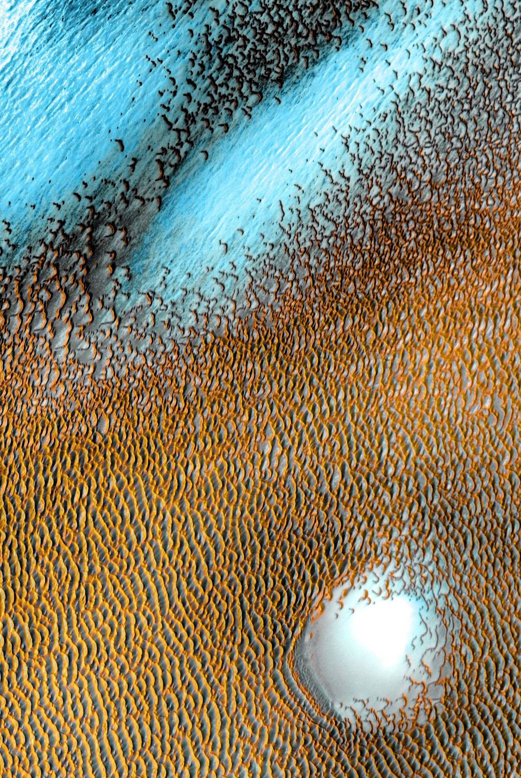
We’ve all heard about blue moons, but what about blue dunes? NASA released a stunning image which has been titled the ‘Blue Dues on the Red Planet’. The image was taken by the infrared camera of the Mars Odyssey orbiter called the Thermal Emission Imaging System (THEMIS).
According to the U.S agency, the dunes surround Mars’ northern polar cap and were created by gusts of wind. The area (image below) which shows the blue dunes covers an area of 19 miles having approximately 80.3 degrees north latitude and 172.1 degrees east longitude.

This particular area is said to have vivid coloring which corresponds with different dune temperatures. These varying colors are primarily false color imaging where the orangey yet yellow-colored dunes signify massive coral reef energy and warmer temperature while the blue areas in the upper left corner of the image show cooler temperatures.
Moreover, according to NASA:
“[the THEMIS] measures the surface temperature day and night, allowing scientists to determine what physical materials, such as rock, sand, or dust, exist. Its data reveals the presence of these materials based on how they heat up or cool down over the course of a Martian day.”
Apart from just assisting scientists in creating maps of Mars, the THEMIS allows the scientists to identify nearly everything from sandstone to salts.
However, it is to be noted that this is primarily a special set of images that mark the 20th anniversary of Odyssey which is currently the longest-working Mars spacecraft in history, operating since 2001.


