Leaf Jiang created laser range devices for the military for more than ten years after the accomplishment of his Ph.D. from the Massachusetts Institute of Technology (MIT). According to his experience, Leaf discovered that laser-based detecting systems were too expensive to be utilized on future autonomous vehicles, which is how NoDar came into the process.
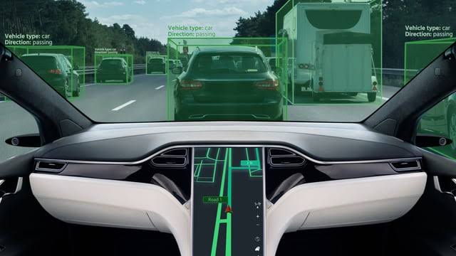
Light Detection And Ranging (LiDAR) system uses laser beams to scan the surroundings and creates 3D images from the data gathered when surfaces reflect the light. LiDAR technologies are essential for mapping roadways, detenting paths, and assisting cars in making crucial judgments about whether an object is a human or a limb of a tree, as companies always want to provide a smooth driving experience to their users. LiDAR is an expensive system and has been built by using many technologies. The system is potent and has the potential to cost tens of thousands of dollars, but it is also prone to failure, not wholly perfect, and needs to provide 100% accuracy. On the other hand, a considerably less expensive option based on one of the most widely used technological gadgets is available, the digital camera Leaf’s startup NoDar promises to provide.
How LiDAR Replaces A Camera?
A camera is an essential tool that helps detect incidents and other vital elements. Camera-based 3D vision has failed several times. Unlike LiDAR, a camera-based system depends on ambient light to produce images. These advanced imaging techniques provide various results depending on the time of day, and they frequently produce low and poor-quality images when it’s raining or foggy outside.
According to NoDAR, “Camera technology has improved over the years. It has also developed proprietary software to get better results from cameras and ensure that they beat LiDAR systems hands down”. NoDAR works on two cameras tied well apart on a vehicle to acquire different versions and various perspectives on the future course. The two different perspectives help make it possible to triangulate an object’s location and distance from the vehicle. Earlier versions of this strategy required perfect calibration to be accurate.
Leaf Jiang’s startup provides user-friendly solutions by auto-calibrating the cameras and syncing up their frames. The company has trademarked the technique for this calibration. Therefore, no additional hardware is required. Moreover, the algorithm can be run in real-time on the chips that cars are equipped with.
How Fast Does It Perform?
To know the efficiency and performance of technology, the company conducted tests at a remote airstrip in Maine, far away from light pollution. The photos captured by two 5.4-megapixel cameras mounted roughly four feet 1.2 m away were compared with data from an advanced LiDAR system. According to an IEEE Spectrum report, NoDAR noticed that its system has the potential to generate 40 mullion data points per second in broad daylight against 600,000 LiDAR. The team has also worked on an automobile simulation chamber that could work again to recreate conditions such as fog and rain for these tests.
When automobiles experience heavy rainfall, the number of data points automatically decreases by 30%, but that for the LiDAR system was previously 60%. However, the camera-based system nonetheless finalized accurate readings for 70% of the distance in constrained fog circumstances with visibility of only around 145 feet (45 m). In contrast, just 20% of measurements made using a LiDAR were correct.
The company wanted an actual test in the night, which is considered as the actual test. Nodar outperformed LiDAR systems by spotting a nearly five-inch (12 cm) piece of lumber from over 400 feet (130 m) away. The high-end LiDAR could spot it only when it was 164 feet (50 m) away. Leaf is very confident in producing a NoDAR system at the cost of the LiDAR system. According to the system experts, the LiDAR system provides a 360-degree view of any vehicle, whereas NoDAR works in only a single direction. If in need of a close look or from every angle, it requires more cameras and computation, which could ultimately increase the cost of a system.
Read more:
China Begins Development Of ‘World’s Most Powerful Warship Radar: Track Multiple Targets Upto Guam


